Using a hire vehicle ? [ Link here ] for extra information.
One of the most frequently asked questions is...... " What will the road be like when I want to come. " Regretfully, we are totally unable to forecast when the roads will open, or in fact offer any advice or road condition information at all.
For the current official information about Kimberley road conditions contact the relevant regional authorities; see our [ Links ] page please.
We can offer a general outline on the effect that the wet season often has on travel in this region.
 |
 |
| Dry Season |
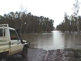
The Drysdale River Crossing |
Wet Season |
These are gravel roads. During the wet season the roads are closed for about 5 months and we are totally cut off. Depending on the size of the wet AND the pattern of rainfall the roads can sustain a lot of damage.
The date the roads open varies but most are normally open by about early May. The road to the Mitchell Plateau can be later opening than the Kalumburu Road is to Drysdale.
Before opening any roads the road authorities inspect for damage and check that the rivers are low enough to cross without the risk of vehicles being washed off crossings.
If there are washouts a grader will be sent to fix danger areas before the road will be opened.
Once the roads are made safe to travel they will be opened.
Then traffic starts getting busier and the corrugations build up. When really bad, the corrugations can seriously damage a caravan or trailers. Especially when you are traveling fast.
Our local roads are maintained by two separate bodies. Main Roads for the Gibb River Road and Shire Wyndham East Kimberley for the Kalumburu Road, so all the road works are not tied to happening at the same time.
When they do a full grade the road is good (for a gravel road), by then in peak season June / July the traffic pours in. People fly along the road and the corrugations fly right in after them.
These roads may be graded one to three times per dry season, but seldom often enough. Main roads or SWEK may also just do the real bad patches because of course on top of all else the road isn't the same all along the more than 1200 km that we are discussing. Some patches have been fully rebuilt in the last few years and they remain great throughout.
There is no way ANYONE can tell you the timing of these grades in advance, so you may have a perfect trip all the way to Kalumburu but a month later, or a month earlier, it can be pretty rough.
Overall the condition of the road especially the creek crossings has improved over the last few years. Driving conditions do hinge on regular grading though.
It is TOTALLY impossible for any of us to advance forecast road conditions or when it may be graded.
The same applies to the other often asked question,
'How much water will be coming over the falls when we come'
This totally depends on the size, length and spread of the wet season, so this is another question that we can simply never answer.
When planning what you need to bring, please remember that we are 1,200 ft altitude and can get the odd very cold night especially in June / July. Perhaps not cold to what you are used to but we feel it requires an extra blanket or a nice jacket when it gets below zero. We have had - 4 °c. overnight.
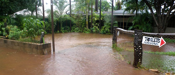
Our wet season is often really wet !
For our advice on Vehicle Breakdowns and Accidents in our area, see the
section on our Roads & Travel Tips page [ here ].
For official advice on roads and weather for this region,
see the listings on our Links page [ here ] page.
Using a HIRE VEHICLE ? Link [ here ] for comment.